How to Read a Fish Finder for Structure
It's incredibly frustrating when you're out on the vast, beautiful waters of an Arizona lake, casting your line time and again, only to come up empty. You know the fish are somewhere down there, but without a clear understanding of what's beneath your boat, it can feel like you're fishing blind. This guide is here to demystify your fish finder, helping you accurately interpret what those squiggly lines and colorful blobs on your screen are telling you about underwater structure, so you can stop guessing and start catching.
Decoding Your Fish Finder Display
When you first fire up your fish finder, it can look like a chaotic mess of colors and shapes, far from the clear picture you might have imagined. But don't despair! With a little know-how, you'll soon be able to differentiate a rock pile from a school of baitfish, and a submerged tree from a thermocline. It’s all about understanding the core components working together to paint that digital picture.
The Role of the Transducer and Sonar Waves
At the heart of every fish finder is the transducer. This unsung hero is essentially both a speaker and a microphone for underwater sound. It sends out sound waves, or sonar pulses, into the water, and then listens for the echoes that bounce back. Think of it like shouting into a canyon and listening for the return sound – the longer it takes, the farther away the canyon wall. Your fish finder works on the same principle, but much faster and more precisely.
The transducer's placement is crucial. Whether it's transom-mounted, through-hull, or trolling motor-mounted, its ability to send and receive clear signals directly impacts what you see on screen. Factors like boat speed, water depth, and even turbulence can affect the signal. In Arizona's deep desert lakes like Lake Powell or Roosevelt Lake, having a powerful transducer with good cone angles is essential for reaching those deep-water structures where larger fish often hide. Modern transducers often use multiple frequencies to provide different levels of detail and depth penetration. High frequencies (like 200 kHz) offer incredible detail and target separation in shallower water, perfect for distinguishing individual fish from structure. Lower frequencies (like 50 kHz or 83 kHz) penetrate deeper, making them ideal for covering vast, deep expanses, though with less detail. Understanding this allows you to toggle between frequencies or use dual-beam sonar for a more comprehensive view of the water column.
Interpreting Colors and Arches
The display itself is where all that raw sonar data is translated into a visual representation you can understand. The color palette on your screen isn't just for aesthetics; it provides critical information about the strength of the sonar return. Typically, brighter, warmer colors (red, orange, yellow) indicate a strong return, meaning the object is dense or close to the transducer. Colder, fainter colors (blue, green) suggest a weaker return, indicating softer material or objects further away.
Fish are often depicted as arches, but not always. A perfect arch usually indicates a fish passing through the sonar cone while your boat is moving. The beginning of the arch shows the fish entering the cone, the middle (often the thickest, brightest part) shows it directly beneath the transducer, and the end shows it exiting. However, if your boat is stationary, a fish might appear as a straight line or a blob. The thickness and brightness of the arch can tell you about the size of the fish and how directly it passed through the sonar cone. For instance, a big, bold, bright arch often means a larger fish, like a substantial largemouth bass lurking near a structure in Lake Pleasant.
Identifying Different Types of Structure
The real power of a fish finder isnies in its ability to reveal the hidden underwater landscape. Fish, especially predatory species like bass and catfish, are almost always associated with some form of structure. Learning to recognize these patterns on your screen is like having X-ray vision into the aquatic world.
Rocky Bottoms, Boulders, and Ledges
Arizona's desert lakes are often carved out of rugged terrain, meaning rocky bottom compositions are incredibly common. On your fish finder, a hard, rocky bottom will appear as a thick, solid line, often brightly colored, indicating a strong sonar return. Boulders will show up as distinct, rounded humps or irregular shapes rising from this hard bottom, with clear definition and bright colors. These can be incredible ambush points for bass.
Ledges, steep drop-offs, and submerged cliff faces are prime real estate for many species. On your screen, a ledge will be characterized by a sudden, dramatic change in the bottom depth, appearing as a sharp vertical line or a very steep slope. Fish often suspend along these vertical walls, particularly in deeper sections, waiting for baitfish to pass by. When you're exploring areas like Canyon Lake or Saguaro Lake, these steep drop-offs and the shadows they create for fish are vital to identify. Mastering Canyon Ledge Fishing Techniques can lead to some incredible catches. Look for breaks in the contour line, which signal these abrupt changes in depth. Often, fish will hold right where the flat bottom meets the vertical drop, or slightly above the deepest part of the ledge, especially during different Arizona Fishing Seasons Explained.
Submerged Timber and Brush Piles
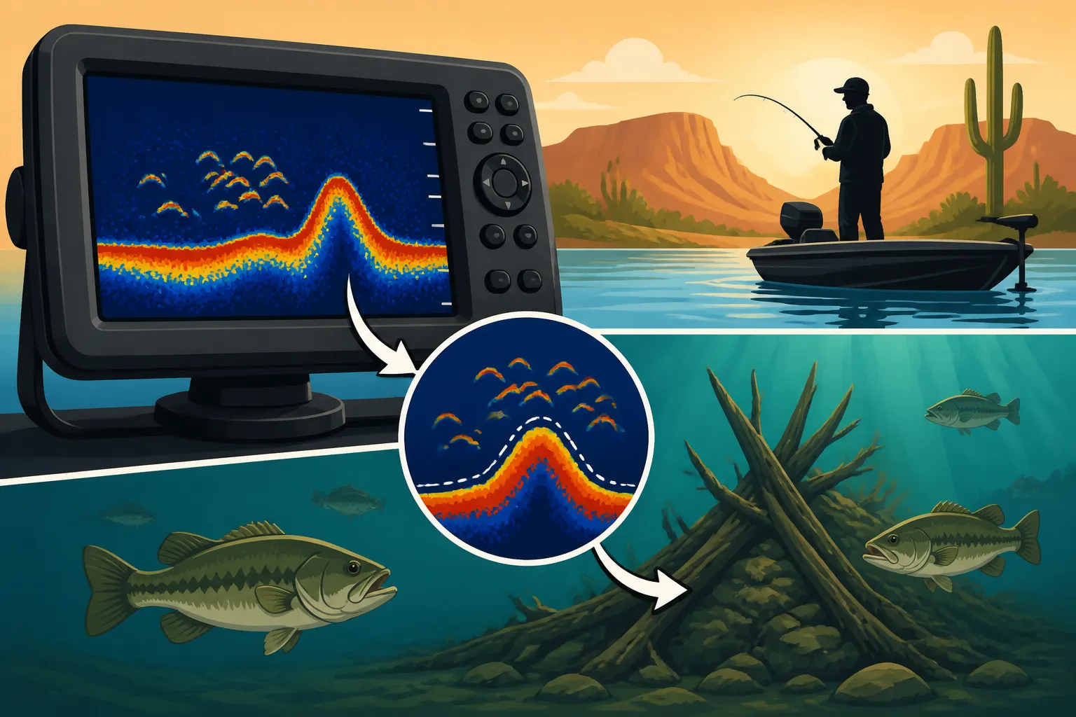
Few structures hold fish as consistently as submerged timber and brush piles. These are often remnants of trees from before a lake was filled, or intentionally placed by anglers and wildlife agencies to create habitat. On your fish finder, submerged timber will typically show up as irregular, vertical lines or dense, "cloudy" masses rising from the bottom. The key here is the irregularity of the shapes – unlike a solid rock, wood has a more varied density, which can lead to a less uniform return.
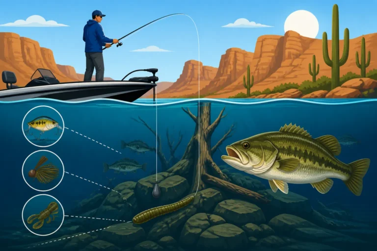
Individual trees might show distinct "branches" if they're large enough, appearing as spikes extending upwards. Brush piles, being a conglomeration of smaller branches and debris, will look more like a dense, fuzzy blob or a "Christmas tree" shape. The brighter, warmer colors within these shapes indicate the densest parts of the wood or, even better, fish holding tight within the cover. These are fantastic places to find crappie, bluegill, and especially largemouth bass. When you locate one of these, you're not just finding structure, you're finding a potential honey hole. Learning Fishing Around Submerged Timber is a game-changer for many Arizona anglers.
Humps, Points, and Submerged Islands
Humps, points, and submerged islands are essentially underwater topographical features that break up an otherwise flat bottom. A hump is an isolated rise in the lake bed, surrounded by deeper water. On your fish finder, it will look like a hill or mound that peaks and then drops back down. Points are extensions of land that stretch out underwater, gradually decreasing in depth. They'll show as a subtle, gradual rise and fall in the bottom contour on your screen. Submerged islands are similar to humps but typically larger, often with more complex contours and cover.
These features act as highways and feeding grounds for fish. For example, a point leading into deeper water on Lake Pleasant could be a prime location for both bass and striped bass to ambush baitfish moving up from the depths. They offer different depths and current breaks, allowing fish to move up and down in the water column based on temperature, light, and feeding activity. Understanding the Seasonal Movement Patterns of Bass at Roosevelt Lake often means understanding how they relate to these kinds of underwater structures. By paying close attention to these subtle changes in depth and contour on your fish finder, you can pinpoint transition areas where fish are likely to congregate.
Interpreting Fish Marks Around Structure
Seeing fish on your screen is exciting, but knowing how they're relating to the structure is what truly makes a difference. Are they suspended above it? Hiding deep within it? Or cruising along its edges? Your fish finder can give you these clues.
Distinguishing Fish from Structure
This is often the trickiest part for new fish finder users. Is that blob a rock, or is it a fish? Here's where understanding colors, arches, and context comes in. As mentioned, fish often appear as arches, especially when your boat is moving. Structure, generally, will be stationary and show up as a consistent bottom return or a defined shape like a tree or rock pile.
The key is often in the separation. If you see distinct, brighter arches above or next to a dense, irregular shape (which is your structure), chances are those arches are fish. If the bright color is simply part of the larger, consistent blob of the structure itself, it might just be a denser part of that structure. However, don't rule out the possibility of fish holding so tight to structure that they blend in. Sometimes, the only clue will be a particularly bright, small patch of color within a brush pile, indicating a fish nestled right into the cover. Experiment with your sensitivity settings – sometimes increasing it slightly can help differentiate fish targets, but too much can clutter the screen.
Fish Location and Behavior Cues
Once you've identified fish, their position relative to the structure offers vital clues about their behavior.
- Fish suspended above structure: If you see arches hovering a few feet above a submerged hump or rock pile, these fish are often actively feeding or cruising. This might indicate that they're comfortable moving around, perhaps chasing baitfish, and might be more willing to strike. These are often easier targets for Topwater Fishing Techniques for Bass or crankbaits.
- Fish buried in structure: When fish marks are directly within or very close to a dense brush pile or timber, it usually means they're seeking cover, ambush points, or shade. These fish might be harder to tempt, requiring a more precise presentation, like jigging or Texas-rigged plastics. You might not see a distinct arch, but rather a bright "speck" within the larger structure return.
- Fish along ledges or drops: Fish hugging a vertical break indicate they're using the contour for cover or to intercept prey. Their position—whether at the top, middle, or bottom of the break—can change throughout the day and with seasonal patterns. Understanding Deep Water Structure Fishing Techniques often involves targeting these specific locations.
- Bait balls: Large, dense clouds of smaller, often fainter returns indicate baitfish. When you see predatory fish (larger, brighter arches) around or beneath these bait balls, you've hit the jackpot. This is a classic feeding scenario, especially for striped bass or aggressive largemouth.
Knowing where the fish are in relation to the structure dictates your next move, from lure choice to casting angle. For instance, a Humminbird or Lowrance unit purchased from a reliable vendor like Amazon might offer features like Side Imaging or Down Imaging that provide an even clearer picture of these relationships, making it easier to pinpoint exact locations.
Advanced Tips for Pinpointing Productive Spots
Beyond the basics, there are several ways to maximize the effectiveness of your fish finder in Arizona's challenging waters. It's not just about seeing the fish, but about using that information to consistently put them in the boat.
Adjusting Settings for Clarity and Detail
Your fish finder isn't a "set it and forget it" device. To truly master it, you'll need to continuously adjust its settings based on the conditions you encounter.
- Sensitivity: This controls how well your unit detects echoes. Too low, and you'll miss fainter returns, like baitfish or fish holding tight to structure. Too high, and you'll get excessive clutter and noise, making it hard to distinguish real targets. A good starting point is usually 75-85%, then fine-tune it. In clear water conditions, like those often found at Lake Havasu, you might need higher sensitivity.
- Scroll Speed: This dictates how quickly the history moves across your screen. A faster scroll speed gives you a more real-time view, which is great for seeing individual fish arches clearly when moving. A slower speed compresses the history, showing more of the bottom contour over a longer distance, useful for mapping out large structural features.
- Range/Zoom: Adjusting the depth range allows you to focus on specific sections of the water column. If you know fish are holding between 20-40 feet, zooming into that range will magnify that section, providing more detail and making it easier to spot subtle fish marks or changes in structure. This is especially useful for targeting specific species like crappie, which often relate to particular depth ranges around brush piles.
- Noise Filter: This feature helps eliminate unwanted interference from your boat's engine, other electronics, or even air bubbles. While generally helpful, be cautious not to set it too high, as it can sometimes filter out legitimate, faint fish returns.
Many modern fish finders, especially those from brands like Garmin or Raymarine (often available through Amazon), have advanced auto-mode features that do a decent job of adjusting these settings on the fly, but for maximum precision, manual adjustment is key. For more in-depth setup advice, consider reading a guide on Best Fish Finders for Bass Fishing in Arizona.
Combining Sonar Views with GPS Waypoints
The true power of modern fish finders comes from integrating sonar data with GPS mapping. When you find a promising piece of structure or a school of fish on your sonar, don't just keep moving – mark it with a GPS waypoint! This allows you to return to that exact spot with pinpoint accuracy.
Imagine you're cruising along the Arizona side of the Colorado River, and your fish finder shows a distinct submerged rock pile with several large arches suspended just above it. Immediately, you mark a waypoint. Now you can circle back, approach from a different angle, and make a precise cast directly to that target. Over time, building a library of these waypoints helps you develop a comprehensive map of productive fishing spots on your favorite lakes, whether it's the vast expanse of Lake Powell or a smaller, more intimate desert reservoir. Many anglers use pre-loaded mapping chips or downloaded satellite imagery to further enhance their understanding of the lake's bottom contours, using the fish finder to verify what the maps suggest. This combination of tools is indispensable for How to Fish Arizona's Desert Lakes effectively.
Understanding Thermoclines and Water Column Layers
In deeper lakes, especially during summer, understanding the thermocline is crucial. A thermocline is a distinct layer in the water column where the temperature changes rapidly with depth. On your fish finder, it often appears as a fuzzy, horizontal line or band, varying in thickness and intensity. Below the thermocline, oxygen levels can drop, making it less hospitable for many fish.
Predatory fish will frequently suspend at or just above the thermocline, as this is where they find cooler, oxygen-rich water and often dense concentrations of baitfish. Knowing where this layer is allows you to target the most productive depth range, rather than casting blindly. For instance, during the warmer months, if your fish finder shows a thermocline at 30 feet, you'll want to focus your efforts in the water column above that line, especially around any structure that extends to or through it. This is a critical piece of the puzzle for Winter Bass Fishing Tactics in Arizona and summer approaches alike, guiding you to where the fish are comfortable and actively feeding.
By diligently practicing these interpretations and integrating the information with your angling techniques, you'll find your fish finder transforms from a confusing gadget into an indispensable tool that dramatically improves your success on the water.
Disclaimer
The information provided in this guide is for general informational purposes only. Fishing regulations, conditions, and fish behavior can change rapidly. Always consult the latest Arizona Game and Fish Department regulations and local advisories before heading out. Fishing involves inherent risks, and it is your responsibility to ensure your safety and comply with all applicable laws.